|

|
Save Our Cabinets
P.O. Box 152
Heron, MT 59844 |
|
Contact
[email protected]
406-544-1494 |
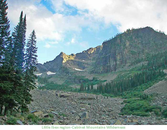
Save Our Cabinets is a Montana non-profit organization.
Our mission is to protect wild lands, wildlife, and water quality
in the Cabinet Mountains of northwestern Montana, especially the
Cabinet Mountains Wilderness Area.
|
- WHO WE ARE
-
IN THE NEWS
▪
BIGHORN
SHEEP
▪
WOODLAND
CARIBOU
- THE CABINET MOUNTAINS
▪
THE KOOTENAI NATIONAL
FOREST AND
WILDERNESS
▪
THE CABINET MOUNTAINS
WILDERNESS
▪
THE LOLO NATIONAL
FOREST AND
WILDERNESS
▪
WILDLIFE NEED
WILDERNESS - THE PIKA
-
ISSUES
▪
THE
MONTANORE MINE
▪
THE ROCK CREEK MINE
▪
THE FOURTH OF JULY MINE
AND WAY-UP MINE
-
PRESS
▪
THE
FLATHEAD BEACON
-
REFERENCE ROOM
-
LEGISLATIVE NEWS
▪ THE
SPORTSMEN'S
HERITAGE ACT
▪
THE
NATIONAL STRATEGIC
AND CRITICAL MINERALS
ACT
▪ THE
WILDERNESS ACT
How You Can Help |
|
WHO WE ARE
Save Our
Cabinets is about keeping the Cabinet Mountains Wilderness free
from the environmental consequences of hardrock mining by
preventing the construction of the proposed Montanore and Rock
Creek mines, and by promoting reform of the 1872 Mining Law.
This archaic law allows corporations to mine national treasures,
such as the Cabinet Mountains Wilderness.
Save Our
Cabinets
is about gaining new wilderness designation to protect
the remaining remnants of wildlands in the Cabinet Mountains
that are threatened by road building and motorized recreation.
Save Our
Cabinets is about protecting habitat for the many species that
are native to the Cabinet Mountains, and preserving and
strengthening the Endangered Species Act that has the power to
protect and recover imperiled species such as the grizzly bear,
lynx, bull trout, wolverine, and fisher.
Save Our
Cabinets is about
fostering appreciation for wilderness, wildlife, and water
quality.
....................................
| |
If you
are interested in becoming a supporter or would like more
information, we can be reached at:
Save Our Cabinets
P.O. Box 152
Heron, MT 59844
406-544-1494
[email protected]
JOIN NOW: Membership
Form
|
|
|